


Worcester Precinct 04-003, Worcester County, Maryland
About
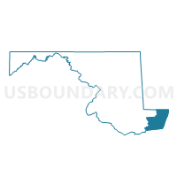
Outline

Summary
| Unique Area Identifier | 593283 |
| Name | Worcester Precinct 04-003 |
| County | Worcester County |
| State | Maryland |
| Area (square miles) | 65.59 |
| Land Area (square miles) | 65.29 |
| Water Area (square miles) | 0.30 |
| % of Land Area | 99.55 |
| % of Water Area | 0.45 |
| Latitude of the Internal Point | 38.37818530 |
| Longtitude of the Internal Point | -75.27594380 |
Maps


Graphs
Select a template below for downloading or customizing gragh for Worcester Precinct 04-003, Worcester County, Maryland


Neighbors
Neighoring Voting District (by Name) Neighboring Voting District on the Map
- Voting District 01-41, Sussex County, DE
- Voting District 03-41, Sussex County, DE
- Voting District 08-38, Sussex County, DE
- Wicomico Precinct 06-001, Wicomico County, MD
- Wicomico Precinct 14-001, Wicomico County, MD
- Worcester Precinct 02-002, Worcester County, MD
- Worcester Precinct 02-003, Worcester County, MD
- Worcester Precinct 03-003, Worcester County, MD
- Worcester Precinct 04-002, Worcester County, MD
- Worcester Precinct 06-002, Worcester County, MD
- Worcester Precinct 06-003, Worcester County, MD
Top 10 Neighboring County Subdivision (by Population) Neighboring County Subdivision on the Map
- Selbyville-Frankford CCD, Sussex County, DE (30,510)
- Laurel-Delmar CCD, Sussex County, DE (23,234)
- District 3, Sinepuxent, Worcester County, MD (9,134)
- District 2, Central, Worcester County, MD (7,112)
- District 6, Northern, Worcester County, MD (7,108)
- District 4, Western, Worcester County, MD (6,487)
- District 14, Willards, Wicomico County, MD (2,106)
- District 6, Dennis, Wicomico County, MD (851)
Top 10 Neighboring Place (by Population) Neighboring Place on the Map
- Berlin town, MD (4,485)
- Selbyville town, DE (2,167)
- Bishopville CDP, MD (531)
- Newark CDP, MD (336)
- Whaleyville CDP, MD (149)
Top 10 Neighboring Unified School District (by Population) Neighboring Unified School District on the Map
- Wicomico County Public Schools, MD (98,733)
- Indian River School District, DE (74,395)
- Worcester County Public Schools, MD (51,454)
Top 10 Neighboring State Legislative District Lower Chamber (by Population) Neighboring State Legislative District Lower Chamber on the Map
- State Legislative Subdistrict 38B, MD (88,842)
- State House District 41, DE (26,231)
- State House District 38, DE (25,569)
Top 10 Neighboring State Legislative District Upper Chamber (by Population) Neighboring State Legislative District Upper Chamber on the Map
- State Senate District 38, MD (134,633)
- State Senate District 20, DE (49,455)
- State Senate District 21, DE (44,799)
Top 10 Neighboring 111th Congressional District (by Population) Neighboring 111th Congressional District on the Map
Top 10 Neighboring Census Tract (by Population) Neighboring Census Tract on the Map
- Census Tract 517.02, Sussex County, DE (5,613)
- Census Tract 9508, Worcester County, MD (5,495)
- Census Tract 106.04, Wicomico County, MD (5,065)
- Census Tract 9510, Worcester County, MD (4,402)
- Census Tract 106.06, Wicomico County, MD (4,200)
- Census Tract 514, Sussex County, DE (3,578)
- Census Tract 9512, Worcester County, MD (3,091)
- Census Tract 9507, Worcester County, MD (2,389)
- Census Tract 9509, Worcester County, MD (2,017)
Top 10 Neighboring 5-Digit ZIP Code Tabulation Area (by Population) Neighboring 5-Digit ZIP Code Tabulation Area on the Map
- 19966, DE (24,601)
- 21811, MD (22,550)
- 19975, DE (8,253)
- 19945, DE (6,862)
- 21813, MD (2,852)
- 21850, MD (2,790)
- 21874, MD (2,210)
- 21841, MD (860)
- 21872, MD (718)
- 21862, MD (106)